Fowey Estuary Lateral Sewer Investigation
Key Achievements
- ~1 km estuary frontage fully mapped and verified
- 100% asset visibility achieved across a previously uncertain network
- Significant reduction in repeat surveys and rework through “first-time-right” delivery
- Non-intrusive methodology eliminated excavation, plant, and reinstatement
- Estimated 70%+ carbon reduction versus traditional investigation methods
- Zero disruption to highways, business activity, or local tourism
- Creation of a reusable digital dataset for long-term asset management
Project Overview
Amplify commissioned Glanville Environmental to investigate foul and combined sewer laterals discharging to the foreshore network beneath the Fowey Estuary, identifying sources of inflow and infiltration (I&I) contributing to hydraulic overloading and spill risk.
The project operated within a complex tidal, environmentally sensitive, and spatially constrained environment where conventional CCTV techniques are limited, particularly when assets are submerged or infiltration occurs only under tidal pressure.
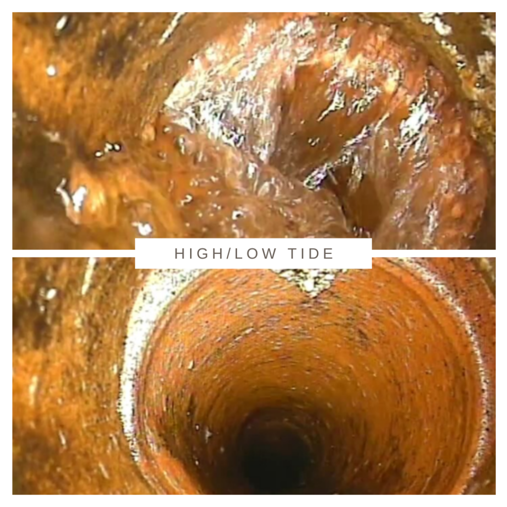
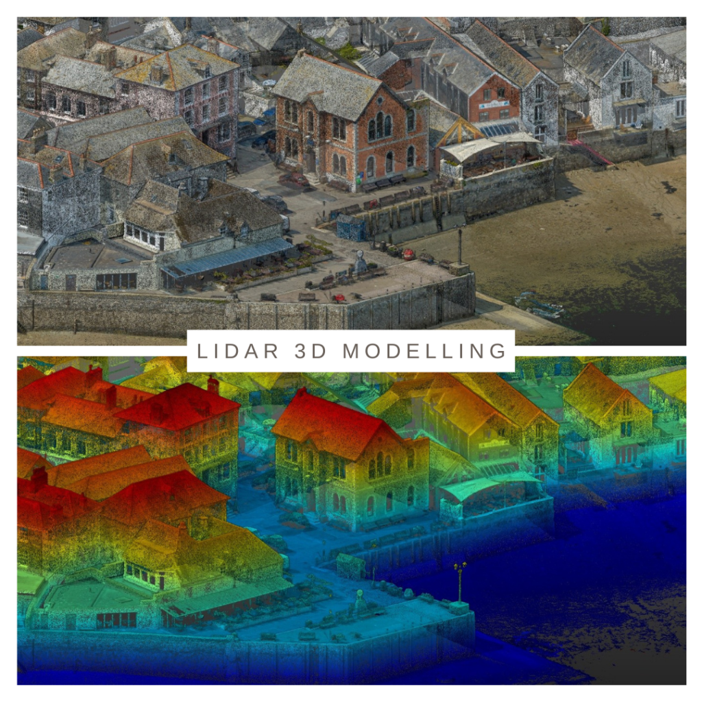
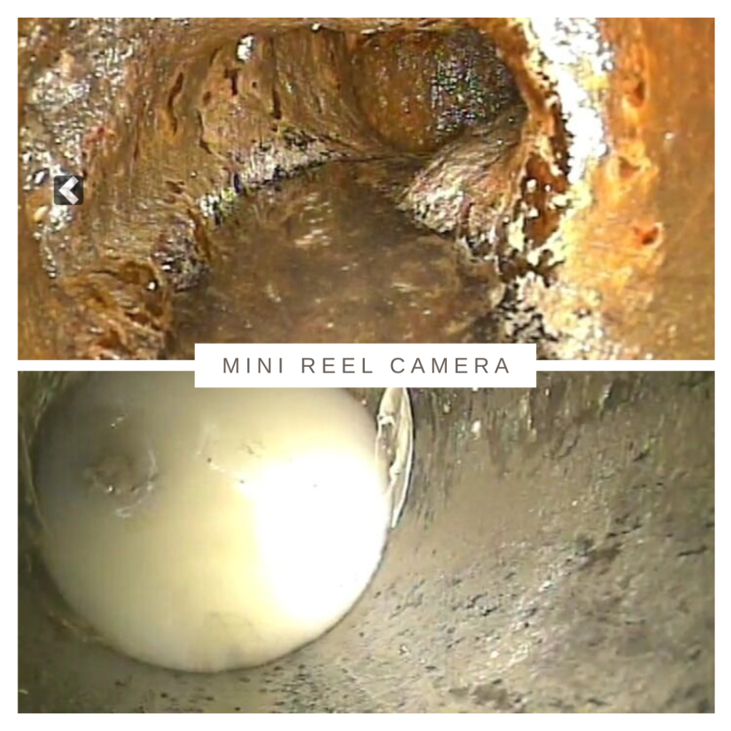
To overcome these constraints, Glanville implemented an integrated inspection approach combining tidal walkover surveys, live infiltration detection using miniature camera systems, and a high-resolution LiDAR-derived 3D foreshore model.
This enabled real-time identification and precise localisation of active infiltration pathways, providing diagnostic accuracy not achievable with traditional inspection methods. The result is a comprehensive, reusable dataset that supports targeted interventions and improved asset performance, delivered through a fully trenchless methodology with minimal environmental and community impacts.
Scheme
Fowey Estuary Lateral Sewer Investigation
Client
Amplify
Project objective
Investigate foul and combined sewer laterals discharging to the foreshore network beneath the Fowey Estuary
Scheme value
Circa £100k
Divisions
CCTV, Geospatial
Project Management
Asset Definition & Control
The project began with a review of legacy records and operational data. Recognising limitations, Glanville implemented a structured asset verification process across ~1 km of foreshore.
Each lateral was physically identified, mapped, and assigned a unique reference, creating a fully auditable asset register. This removed uncertainty and ensured all assets were accounted for, providing a reliable baseline for investigation and future planning.
Tidal-Sensitive Programming
Work was aligned to tidal cycles to ensure safe access, consistent visibility, and controlled inspection conditions.
Engineers remained in position across tidal changes, directly observing infiltration as water levels rose. This allowed defects to be proven under live hydraulic conditions, significantly increasing confidence in findings.
Efficient Delivery & Cost Control
A multi-disciplinary approach combined lateral inspection with property-level checks, reducing mobilisation and enabling complete data capture in a single visit.
The “first-time-right” methodology minimised rework and created long-term cost efficiencies, reducing the need for repeat investigation and supporting immediate decision-making.
Delivery in Constrained Environments
Challenging access conditions required coordination with the Harbour Master and use of marine access, including water taxis and low-tide foot access.
This adaptive approach ensured safe, continuous delivery despite spatial constraints.
Community Impact & Customer Care
Stakeholder Engagement
A structured engagement strategy supported access to a mixed residential area with a high proportion of second homes.
This included coordinating with property owners, local stakeholders, and businesses to improve access rates, reduce delays, and build positive relationships for future work.
Minimised Disruption
The trenchless methodology ensured works were delivered without:
- Road closures
- Heavy plant
- Noise or visual disruption
Scheduling avoided peak tourism periods, maintaining normal community and business activity.
This demonstrates how advanced inspection techniques can deliver complex investigations with near-zero disruption.
Legislative Compliance
All works were delivered in accordance with CDM Regulations and client safety standards.
Risk Management
Key risks included tidal movement, unstable ground, and restricted access. These were mitigated through:
- Dynamic risk assessments
- Continuous tidal and weather monitoring
- Defined safe systems of work
- Rescue planning
- Risk Reduction via Methodology
The trenchless approach reduced risk by:
- Eliminating excavation hazards
- Minimising confined space entry
- Reducing interaction with live infrastructure
- The project maintained a strong health and safety record, demonstrating effective planning and control.
The Benefit
Sustainability
Low-Impact Methodology
The use of compact camera systems, LiDAR survey, and digital modelling enabled full inspection without excavation or heavy plant.
Carbon & Resource Efficiency
The integrated approach reduced repeat visits and eliminated material waste, delivering an estimated 70%+ reduction in carbon impact compared to traditional methods.
The creation of a reusable digital model further reduces future survey requirements and associated emissions.
Long-Term Environmental Benefit
By identifying infiltration at source, the project supports:
- Reduced hydraulic loading
- Improved pump efficiency
- Lower energy consumption
- Reduced storm overflow risk
This demonstrates a direct link between inspection and long-term environmental performance.
Innovation
Integrated Survey Approach
The project showcases a novel combination of inspection technologies that overcomes the limitations of traditional methods in tidal environments.
LiDAR 3D Foreshore Model
A high-resolution LiDAR survey created a 3D model of the foreshore, enabling:
- Accurate positioning of assets
- Analysis relative to tidal levels
- Repeatable digital inspections without site return
Mini Reel Camera Technique
A bespoke methodology was developed to detect infiltration under tidal conditions:
- Mini camera installed at low tide
- Left in place as the tide rises
- Infiltration observed under pressure
- Camera withdrawn to pinpoint ingress location
This provides:
- Real-time verification of infiltration
- Precise defect localisation
- Robust visual evidence
Data Integration
Survey data (tidal conditions, asset levels, infiltration behaviour) were combined into a structured dataset, enabling:
- Prioritised investment
- Targeted rehabilitation
- Long-term asset management
This transforms inspection into a data-driven, strategic capability.
Conclusion
The Fowey Estuary Lateral Sewer Investigation demonstrates how innovative detection and inspection techniques can overcome complex environmental constraints.
By integrating tidal planning, digital modelling, and real-time infiltration detection, Glanville Environmental delivered a step change in inspection capability. The project provides a high-confidence, reusable dataset that enables targeted interventions, reduced hydraulic loading, and improved network resilience.
Delivered through a fully trenchless, low-impact approach, it sets a benchmark for safe, sustainable inspection in sensitive environments and demonstrates how innovation can transform inspection into actionable intelligence.